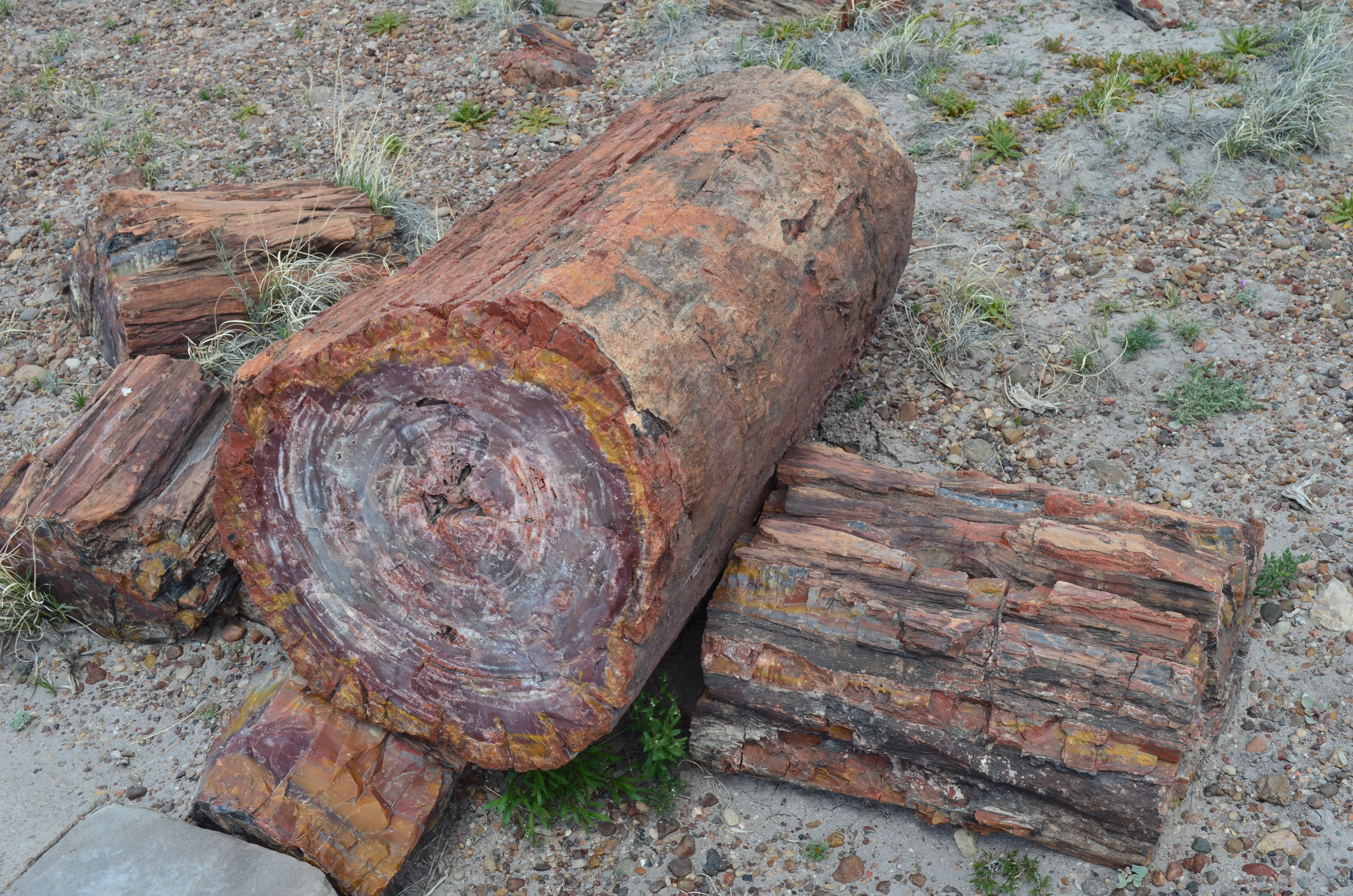
The Petrified National Forest features two distinct sections – the southern end near Holbrook, AZ and the northern end just off I-40, which includes the Painted Desert.
First protected as a National Monument in 1906 and upgraded to a National Park in 1962, only 600,000 people visit annually. Coming from Flagstaff, we exited I-40 at Holbrook and traveled 20 miles on US Hwy 180 to the southern entrance station. From that entrance to the other end of the park is 28 miles, but packed with geological wonders.
The southern section focuses on six “forests” that contain petrified logs. Over 200 million years ago, this land hosted trees along a river system. Over time, the trees died and volcanic ash buried them. Later, the area rose above sea level and became the arid desert it is today.
To really appreciate these fossilized trees, visitors need to get out of the car at one of the many stops.
Rainbow Forest Museum
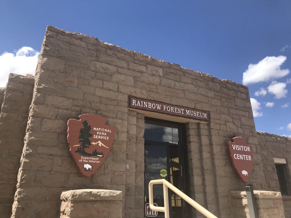
What makes wood petrify? If you’re like me, it’s something learned in elementary school and quickly forgotten. Stop by the Rainbow Forest Museum, which also serves as a visitor center, for a short film that explains the petrification process.
Giant Logs Loop
Behind the museum lies the short, 0.4-mile Giant Logs Loop. Located in the open desert, you can see for miles. Large logs lay on the ground and it’s not until you look at the inner tree that you see the multitude of colors and stone.
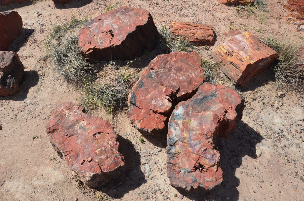
We noticed that most of the logs seemed to be cut in clean sections. Surprisingly, forces of nature did this when the Colorado plateau rose some 60 million years ago. The movement of the plateau caused stress fractures and the hard, brittle properties of quartz allow clean breaks. If a human tried to cut the logs, it would take a diamond saw!
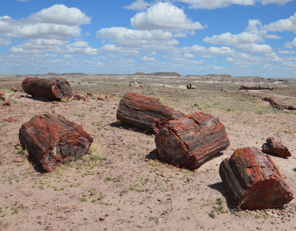
If you only have time to do one trail, Giant Logs Loop fits the bill. It offers a concentration of petrified logs on a paved path. Take advantage of the restrooms and gift shop inside the museum because you won’t find them again until the northern section.
Crystal Forest
Wanting to see more petrified logs, we decided to stop at Crystal Forest and took the easy, 0.9-mile loop. Once again, the logs seemed to be cut in clean sections.
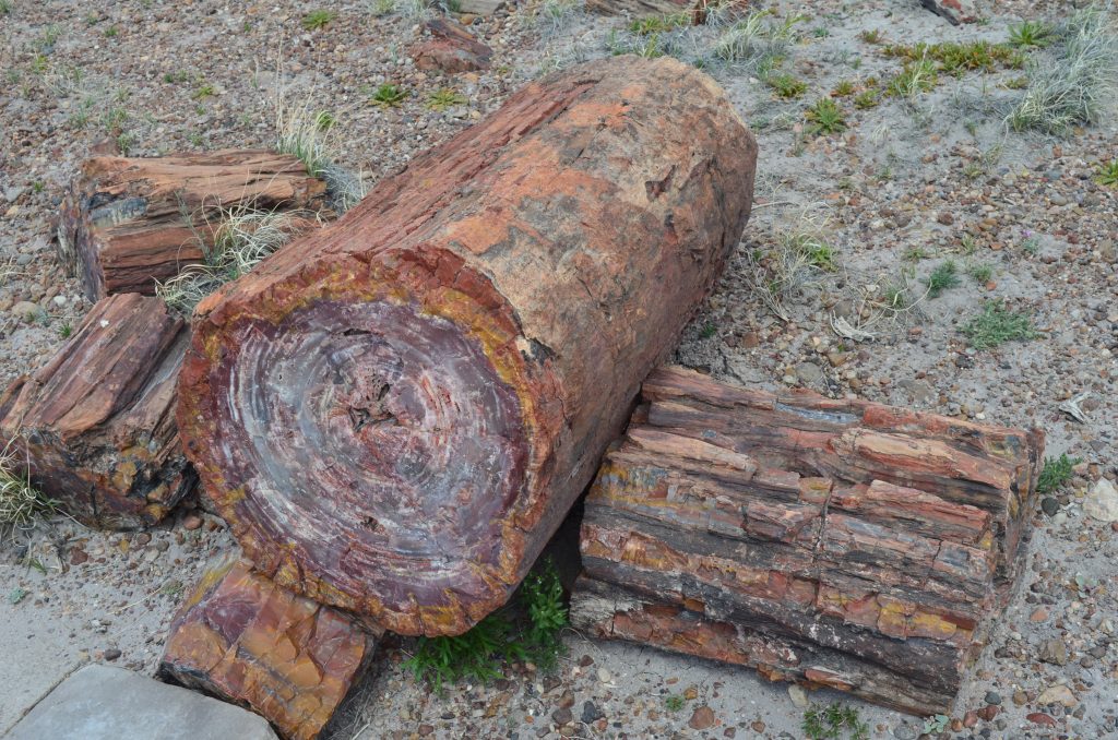
Although we enjoyed the trail, it was very similar to Giant Logs Loop. If you’re in a pinch for time, I’d skip this.
Also, don’t let the name fool you. All the petrified logs in the park have crystal specks from the quartz. Our park brochure confirmed there isn’t a higher concentration of crystals here.
Agate Bridge
Not all petrified logs break into small sections as evidenced by our next stop. The 110-foot petrified log that serves as Agate Bridge landed on the ground. Because it had already turned to stone, the tree didn’t erode while the soft ground underneath it did.
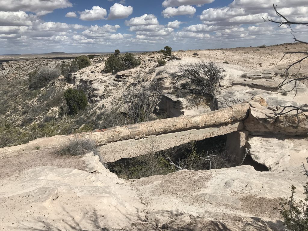
The stop only takes a few minutes and people aren’t allowed to walk on the bridge. In the park’s early days, wooden beams supported the log until officials replaced it with the concrete span in 1917. The other thing to note is that there used to be a restroom here and was still listed on our map. That is no longer the case as they have converted the area into a picnic shelter.
Blue Mesa
A 3.5-mile loop road off the main thoroughfare leads to the Blue Mesa. Although the least visited part of the park, it is the most unusual with bands of blues, purples and grays among the badlands.
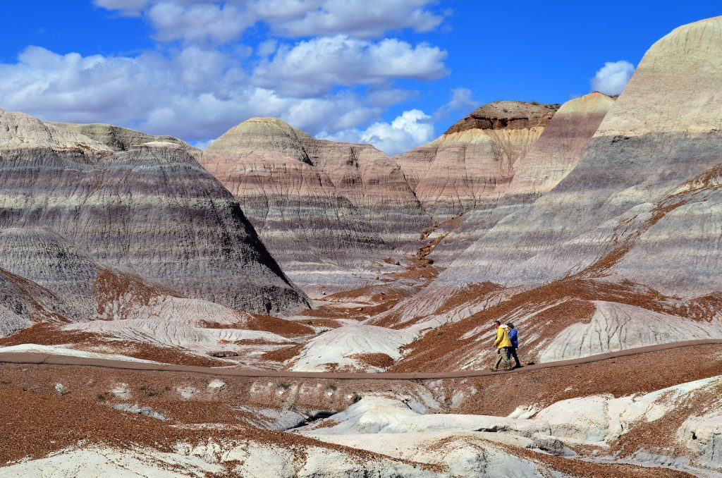
From the parking lot, we took the moderate, 1-mile Blue Mesa Trail that led us down 120 feet into the valley floor. Although we passed by some petrified logs, our eyes focused on the multi-striped hills around us.
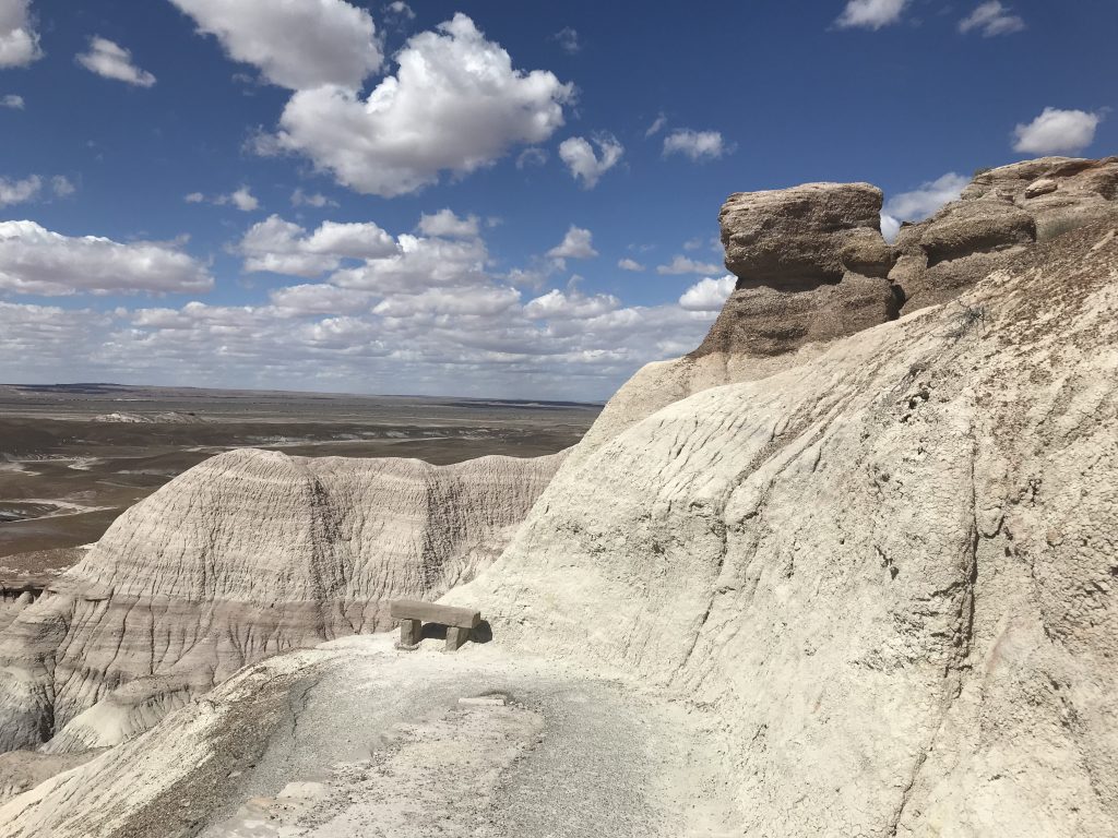
This area is part of the Blue Mesa Member of the Chinle Formation. In simple terms, these hills and mesas are the result of millions of years of erosion. The NPS website describes it better here. Mostly made up of bentonite clay which swells and shrinks constantly, vegetation doesn’t grow on the formation, giving visitors a feeling of being on a moonscape.
Route 66
No trip to the Southwest is complete without paying tribute to Route 66. Although decommissioned in 1985, the “Mother Road” or “America’s Highway” played a vital role in early automobile travel.
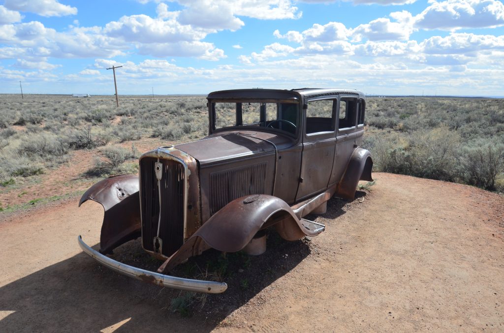
The park road crosses the old Route 66. We could see the telephone poles that lined the original roadbed. A rusted out 1932 Studebaker sits by the side of the road. When the Oakies moved from Oklahoma to California, this was the route taken.
For more Route 66 nostalgia, spend some time in nearby Holbrook. It felt like the land that time forgot with kitschy statues of dinosaurs and rock shops.
Once you cross the old Route 66, you’re in the northern section of the park which includes the Painted Desert.
