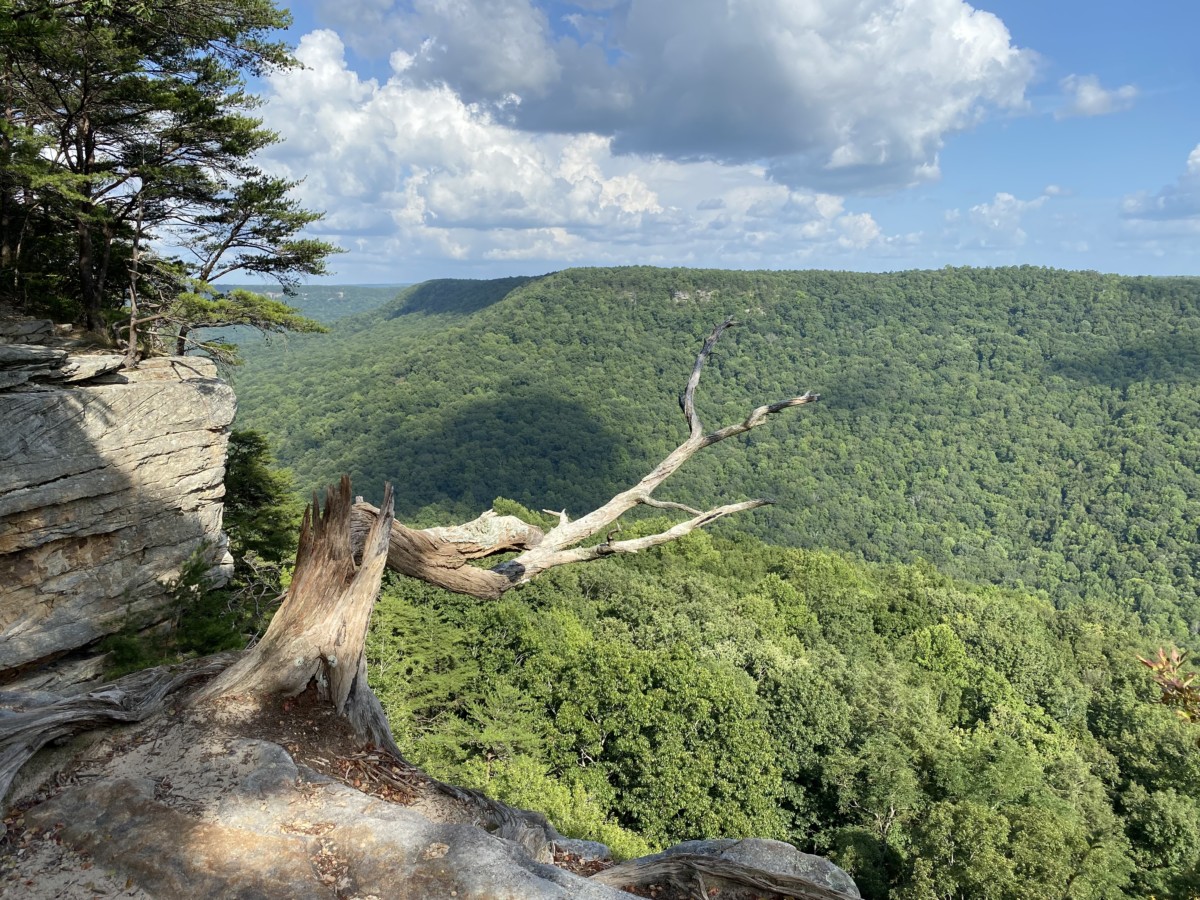
South Cumberland State Park lies in rural Tennessee near 1-24 between Nashville and Chattanooga. The park’s 31,000 acres on top of the Cumberland Plateau spans four counties: Franklin, Marion, Grundy, and Sequatchie, making it Tennessee’s second-largest park.
About two-thirds of the acreage lies in the Savage Gulf area near Altamont and Beersheba Springs. Both the Fiery Gizzard section and Grundy Lakes are near Tracy City. The Lost Cove area lies on the western side of I-24 near Sewanee in Franklin County. Although we didn’t stop, a visitor center sits between Lost Cove and Fiery Gizzard in Monteagle, TN.
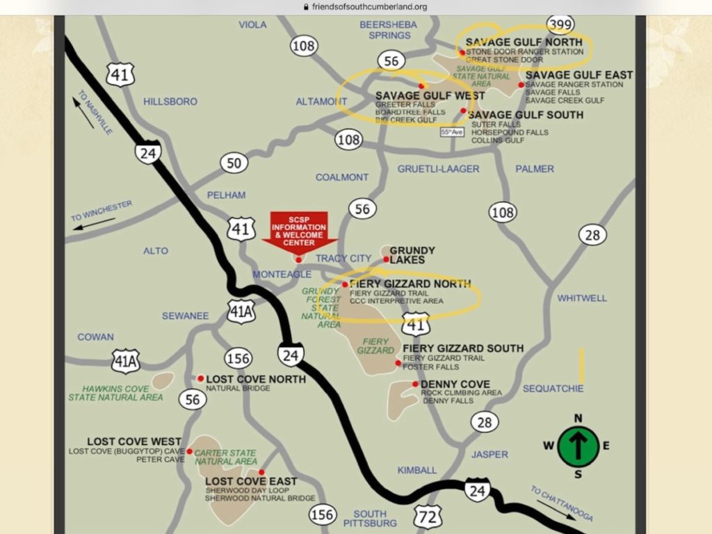
To better describe this, I’m including a screenshot of the park map from friendsofsouthcumberland.org. I’ve circled the three areas highlighted in this post.
Grundy Day Loop at Fiery Gizzard
We took the 2.0 mile Grundy Day Loop in Tracy City. The parking lot is near a high school so if parking spots are taken, you can park at the school. I don’t think you can go wrong either way, but reviewers suggested hiking this loop in a clockwise direction.
Near the beginning, the trail descends steeply down some rocks to Cave Springs Rock House. and a large cave-like overhang appears. The trail follows Little Fiery Gizzard Creek passing by Blue Hole Falls. Although only 10 feet tall, the pool below offered a great swimming hole. About 0.7-mile in, a new steel bridge takes visitors across the creek to Sequoyah Falls and the continuation of Fiery Gizzard Trail. Knowing we had other hikes to do, we stayed on the Grundy Day Loop instead.
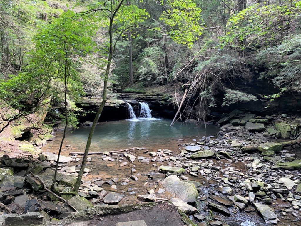
About this point, Little and Big Fiery Grizzard Creeks merge. Soon after, we came to Hanes Hole Falls, the almost symmetrical twin to Blue Hole Falls. With about 0.75-miles left, we slowly started an ascent. The trail soon departed the creek and steps led us into the Grundy Forest.
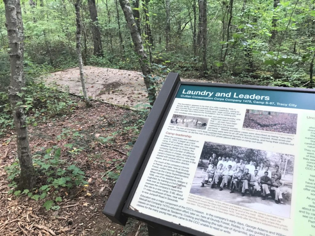
Serendipitously, a short CCC Camp trail departed the path. At just 0.3-miles, this loop provides a historical overview of the park. In 1935, local businessmen pooled $350 to purchase this area in hopes of attracting the CCC to set up camp. They were successful as CCC Camp 1475 stayed for several years, constructing the nearby Grundy Lakes, blazing hiking trails, and erecting much-needed fire towers. We walked past the remains of the bathhouse, mess hall, barracks, fire tower, and other buildings while reading detailed plaques describing the conditions.
Back on the Grundy Day Loop, we only had about 0.50-miles to the end winding through the forest. The well-marked, white-blazed trail has lots of stumps and rocks so wear hiking boots if you have them. If not, take a walking stick for extra assistance. Ranked intermediate, we didn’t find this trail too difficult. Supposedly, the elevation change is 2,000 feet, but it didn’t feel that steep. Restroom facilities and a picnic shelter are available at the trailhead. Parking is free.
Greeter Falls
Greeter Falls is a short, 0.5-mile hike that packs a lot of punch. However, short doesn’t mean easy. Rated intermediate, you definitely will have rocky terrain near the waterfalls and it can be slippery after it rains. The trail begins flat and a small 0.2-mile spur trail allowed us to see the Greeter Homestead first. After passing huge cliffs, we began the rocky descent to Lower Greeter Falls. The first view of the falls appears while taking the metal spiral staircase built into the side of the cliff. Although I usually don’t like heights, the stairs didn’t bother me. After another staircase (this time, wooden and straight) the trail ends on the rocky bottom of the canyon. Surrounded by canyon walls, the waterfall refreshed swimmers.
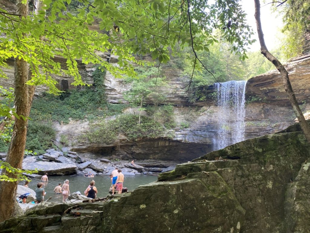
The trip back to the top of the bluffs seemed daunting on this hot summer day. Dear Hubby (DH) wanted to sit while I continued the rest of the loop to Broadtree Falls. At times, I wasn’t sure I was still on the trail and there were several spots of rock scrambling. Unfortunately, Broadtree Falls was dry due to lack of rain and I connected back to the main trail.
Stone Door
Our last hike for day began a few miles up the road from Greeter Falls. People can hike the 5 miles between the two, but we were getting tired. Just past the restrooms and small ranger station, we started the flat, paved trail.
Soon the Laurel Gulf Overlook with an observation deck appeared. I could honestly have stayed here as it was beautiful and relaxing. From here, the trail became dirt but still was relatively flat. At about 1 mile, a sign pointed to the overlooks and the stone door.
The overlooks gave us mesmerizing views of the Savage Gulf. I kept looking for a stone door in the distance. Was it just some door somebody built? I couldn’t figure it out.
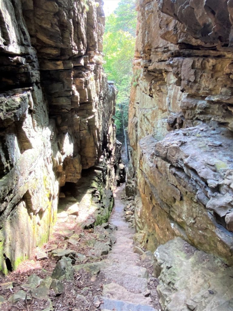
As we left, I noticed a trail winding down a steep set of stairs between two rock formations. That’s when DH told me it was the stone door. Go to the bottom and when you look back up, it appears to be a doorway.
Our day of hiking gave us three different experiences at South Cumberland State Park. The first was a wooded hiking trail, the second was a waterfall and the third was several high overlooks of the mountains. One thing to note is that both Fiery Gizzard and Stone Door required hikers to sign in and out. You just simply write your name and the time of your hike on the clipboard near the map. When you finish, just put in the time you finished.
For more information about the park, click here.
