After spending a few days with family over the Christmas holidays in Palm Desert, I needed time to myself. Since the sun set early – before 5 p.m. – I knew that if I wanted to hike alone, I would need to hit a trail earlier in the day. I read up on the Palm Desert Cross Trail, located about 10 miles away.
The Palm Desert Cross Trail
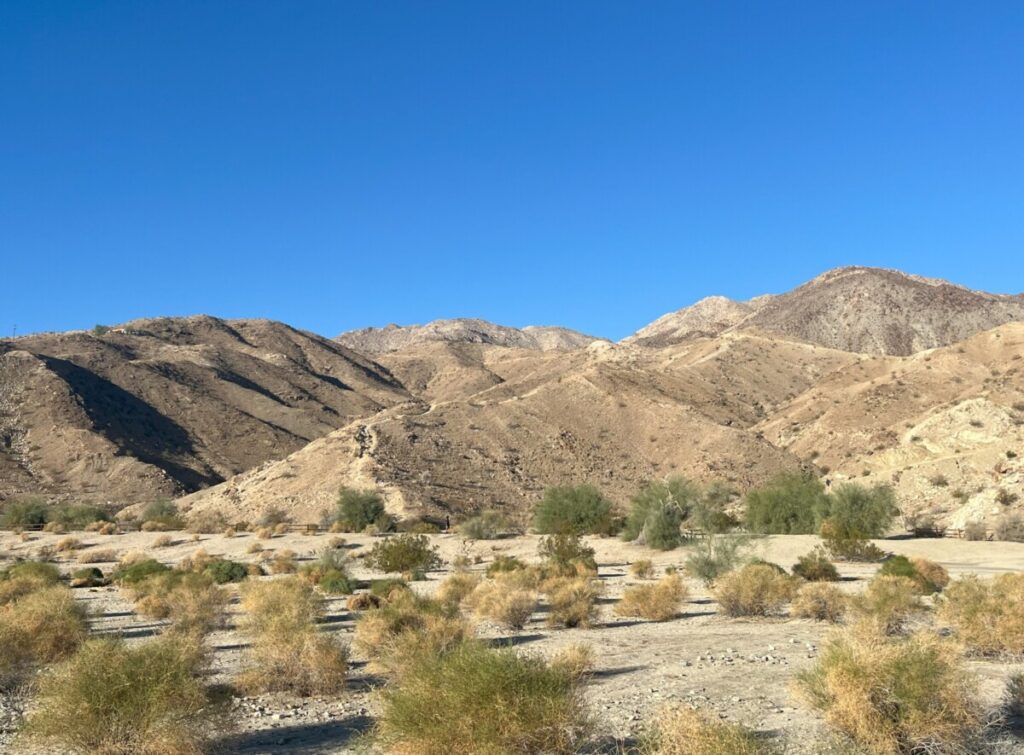
The trail is a moderate, 2.2-mile hike that climbs over 600 feet to a 30-foot-tall Cross. I left the condo around 7:15 am just as the sun was rising. Because all the streets in Palm Desert are laid out in a grid, it was easy to find the area – just south of Fred Waring Drive off of the Pines to Palms Highway. Turning west onto Thrush Ave, I found the parking area at Cap Homme/Ralph Adams Park. It’s basically an unpaved road but plenty of other people had already parked.
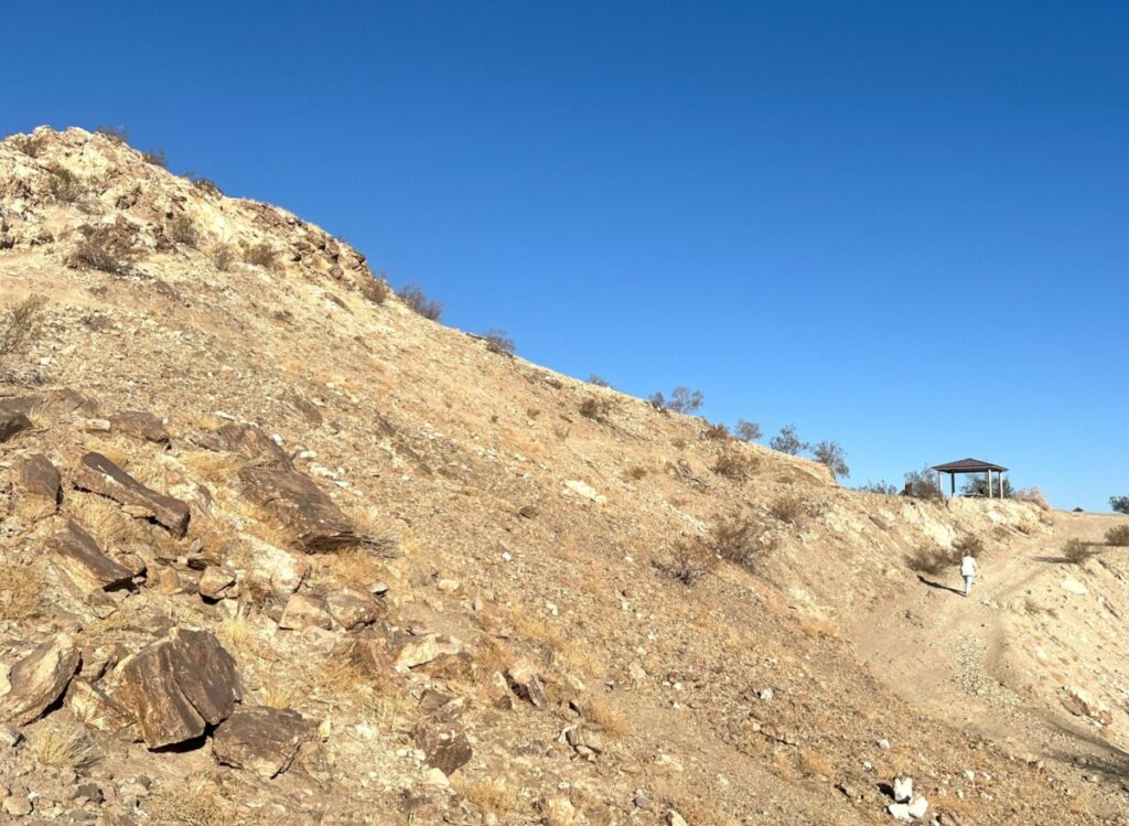
For such a popular trail, there wasn’t much signage. I found a sign pointing to the Homestead Trail. At the time, I didn’t realize this was another name for the Cross Trail. I randomly followed a hiker on the trail to a small pavilion area. The sign pointed to the left, so I followed.
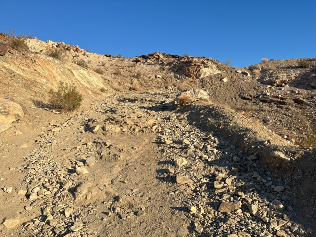
At this point, I could tell I was ascending the mountain, which is part of the Santa Rosa and San Jacinto Mountain National Monument. I hiked up several switchbacks on a somewhat rocky trail. The other hiker was now nowhere to be seen, and I wondered if I should turn around. I’m a bit afraid of heights, but I decided to keep going since the views were amazing.
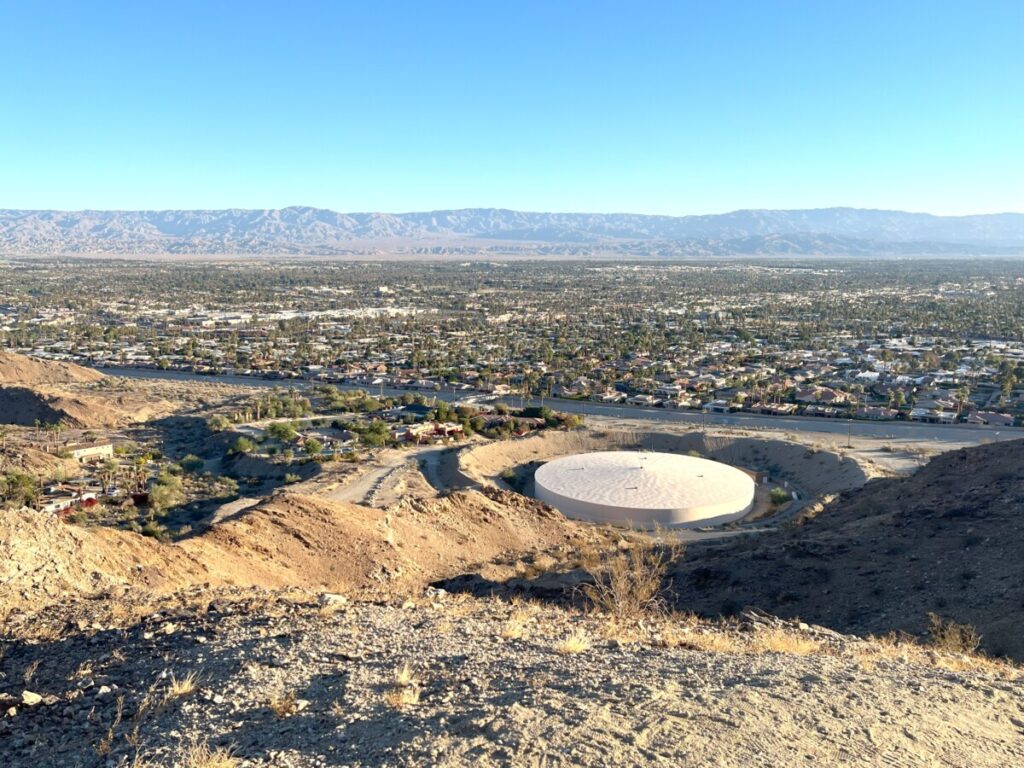
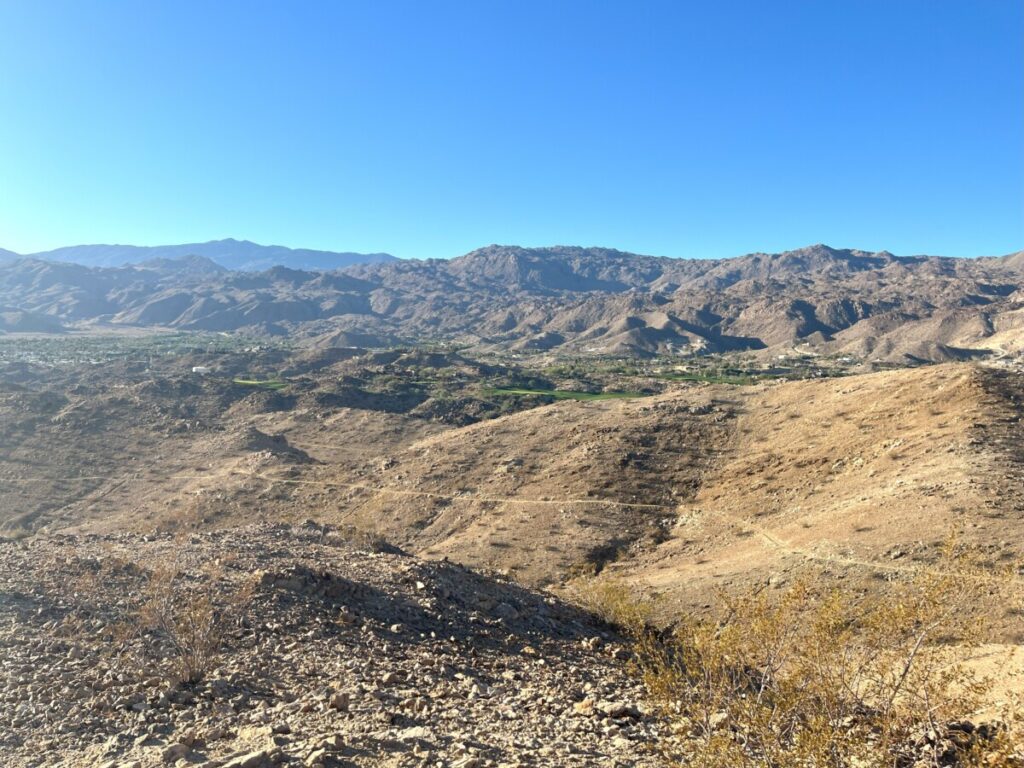
Several times, the switchbacks gave me views of Palm Desert and a circular building below. Each time, I was at a higher elevation so I could see I was making progress. Soon, the trail straightened out and headed west – away from Palm Desert. I finally spotted a couple of women coming from the opposite direction. They assured me that I was on the right path and told me to veer left at the next sign.
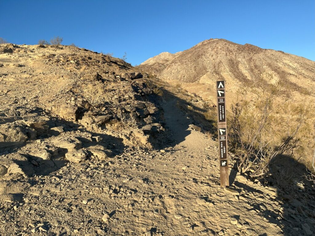
By this point, I thoroughly enjoyed the trail. I couldn’t see the Cross yet, but the trail was astounding. Even though most of these pictures in this post look the same – a brown desert trail with no vegetation – it wasn’t. Each bend afforded different views. Although I was still hiking uphill, it didn’t feel as steep. At the junction with the Hopalong Cassidy Trail, I headed left onto the Cross Loop Trail.
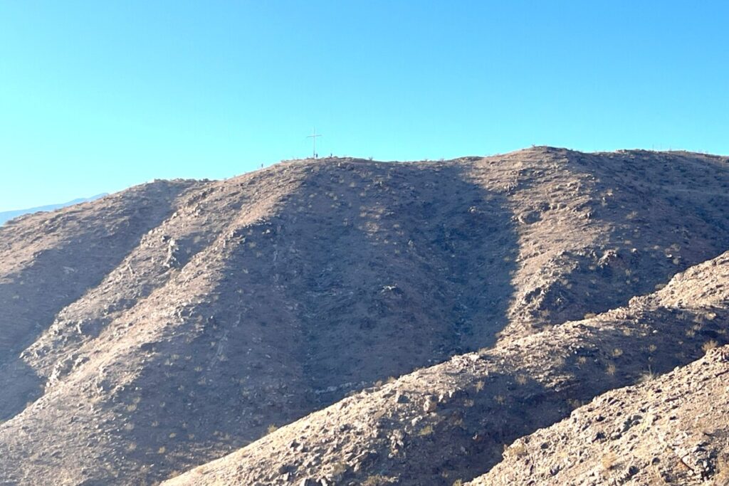
A few minutes later, I could see the cross in the distance. And I could see people up there so I knew I wasn’t all alone. The trail basically hugged the mountainside. I could see I had many more feet to climb but the end was in sight.
At the Top
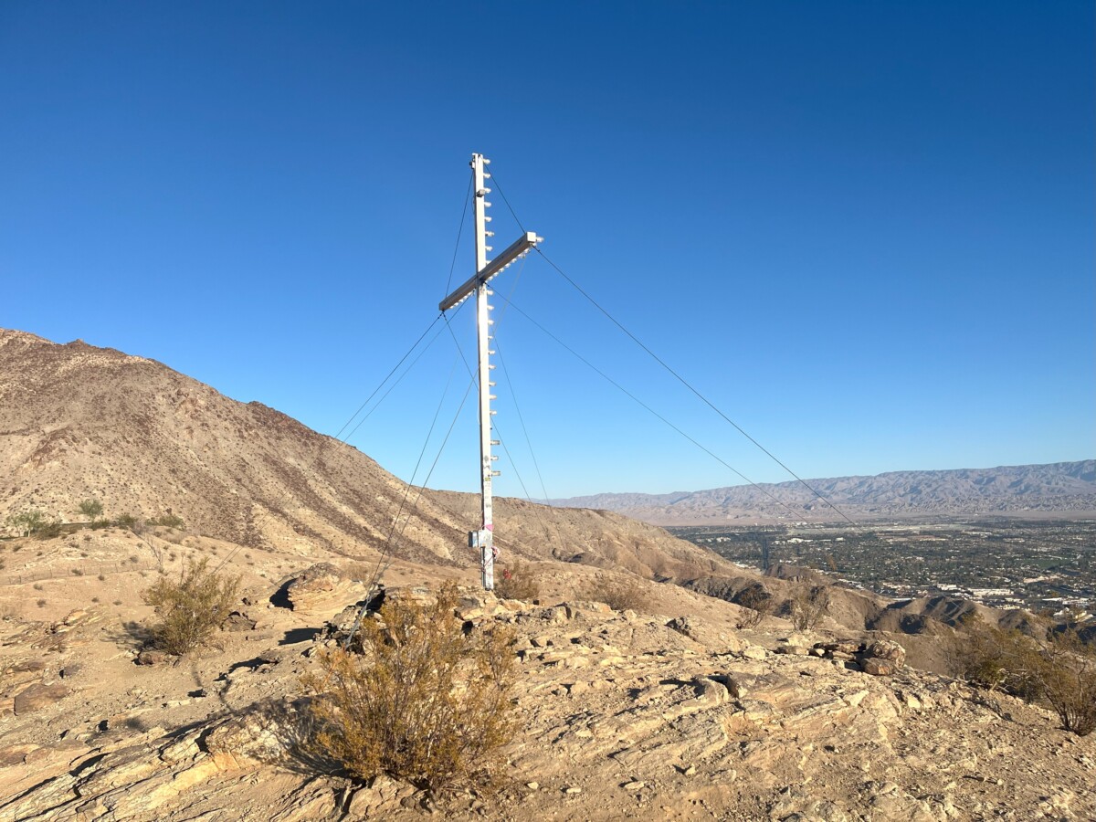
At the top, the tall metal cross greeted me. Because it’s so tall (30 feet), it was hard to look up without feeling I would fall backward. Multiple guy wires secure the Cross, which is illuminated every evening, to the mountaintop.
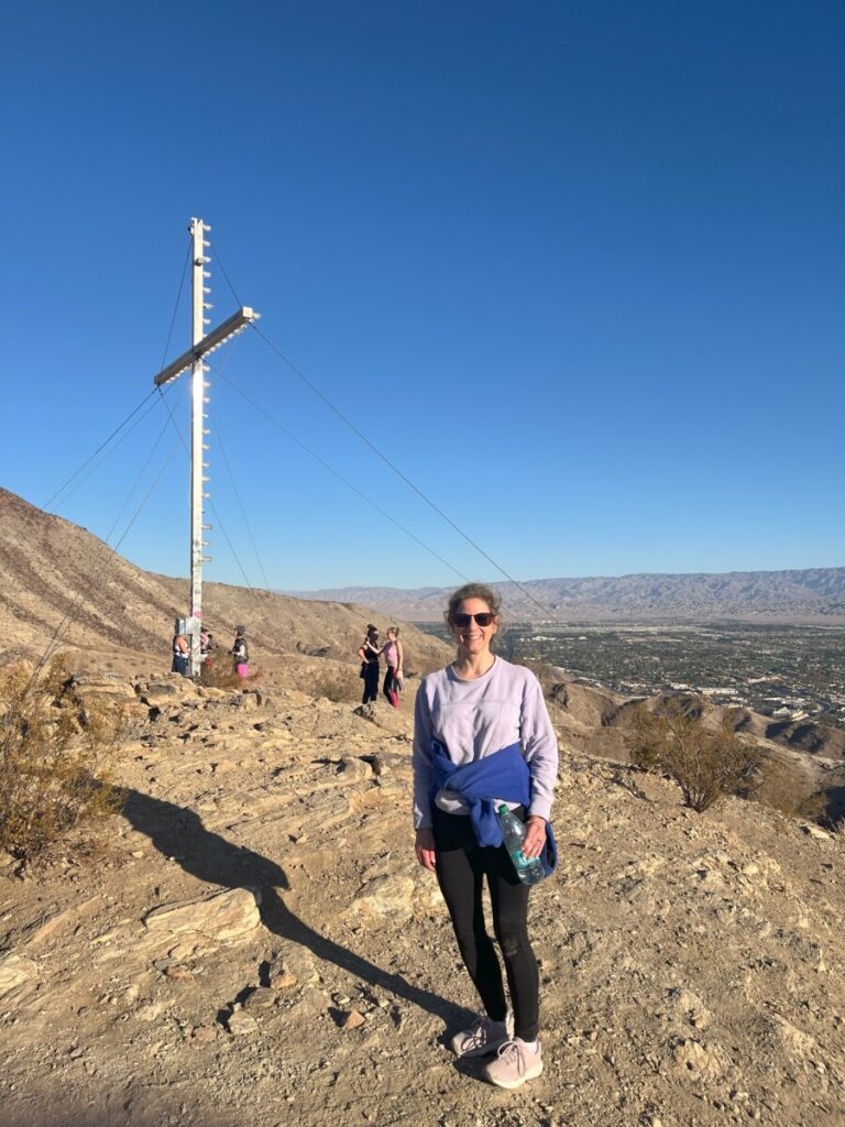
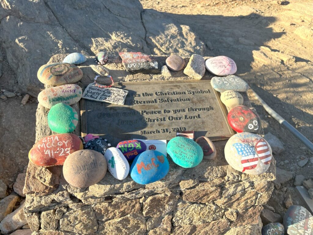
The Cross faces Palm Desert and the way it’s perched on the mountain, it’s difficult to get a picture of the front of it. Most of my views were from the back and sides of the Cross. Near the base, visitors have left colorful, painted rocks.
Cross Trail Descent
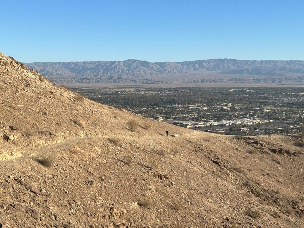
After spending a few minutes taking in the views, I backtracked the same way to the parking lot. In the distance, I could see the trail hugging the mountainside. I really had hiked a long way.
As the temperatures warmed up, I started seeing more people on the trail. Many hikers brought dogs with them. It never was crowded and I only saw groups of two to four people at a time.
Back at the parking area, I noticed picnic tables and what looked to be a few more trails. The entire hike took just about an hour.
So, how did this Cross get here? Back in 1981, college student Mark Stembler erected the wooden Cross. He provided the electricity from his cabin nearby. In 1996, St. Margaret’s Church took over the maintenance of the Cross and replaced the existing one.
In Conclusion
The Palm Desert Cross Trail, also known as the Homestead Trail, is an excellent overview of Palm Desert and the mountains. Two things to note: I hiked this a few days after Christmas when the temperatures were moderate and early on a Sunday morning when I didn’t hear traffic sounds coming from the nearby Pines to Palms Scenic Byway.
If you are hiking during hot temperatures, bring lots of water. Also, wear a hat and sunscreen since there is no shade. Parking is free. Although I noticed one water fountain, I didn’t see any restrooms. Bring a trail map since signage is limited. Check out the post I found (after the fact) written by The Hiking Guy. I also referenced his website in my previous post about Joshua Tree National Park.
Pingback: WildLights at Living Desert Zoo & Gardens - Palm Desert, CA • Finding Family Adventures