A while back, I wrote a post about the two-mile hike up to Kennesaw Mountain. At 1,800 feet, the summit offers visitors 360-degree views of Atlanta and the North Georgia mountains. While a popular hiking spot for Atlantans, many overlook the museum inside the visitor center, which details the Battle of Kennesaw in 1864.
Thing 1, a recent college graduate with a major in Public History, has moved home and we’ve enjoyed exploring museums and historical spots around the Atlanta area. In all my visits to Kennesaw Mountain, I’ve never ventured to the museum or watched the historic film about the battlefield. Nor had I ever explored more trails of the almost 3,000-acre park.
Museum at Kennesaw Mountain
Entering the visitor center, we learned that the 35-minute film “One Last Mountain” begins a quarter after each hour. The park ranger gave us a map, stamped Thing 1’s National Park Passport, and suggested we tour the museum while waiting for the film to begin.
The museum space was doubled with an extensive renovation in 2002. A timeline begins with the 1860 Presidential election through the first few years of the Civil War. Inside the exhibit, the Battle for Atlanta is highlighted, beginning with the key players. The Union troops sought to capture Atlanta as it was the terminus point of four railroads, a supply center, and a manufacturing and textile hub.
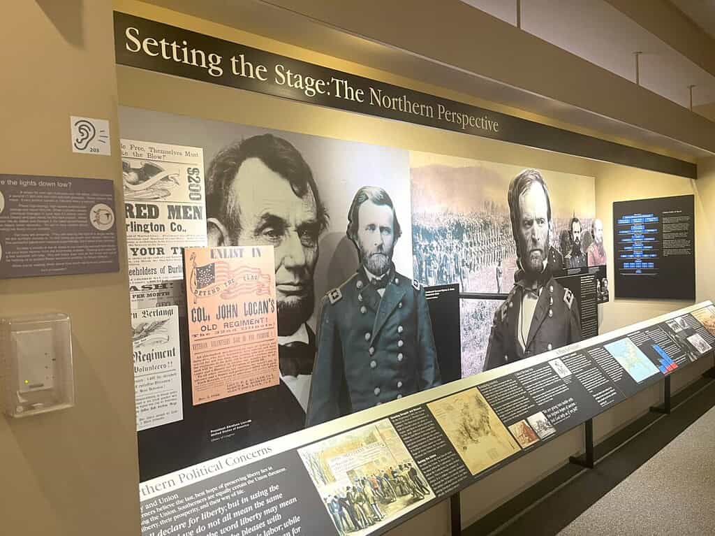
Artifacts include a carding machine used in the area textile mills, Confederate currency, canteens used by soldiers, and rifles. An interesting fact was that soldiers were almost safer on the battlefield than sitting in the camps due to dysentery, malaria, and yellow fever. After all, soldiers drank water from streams and mud puddles, while many canteens contained lead.
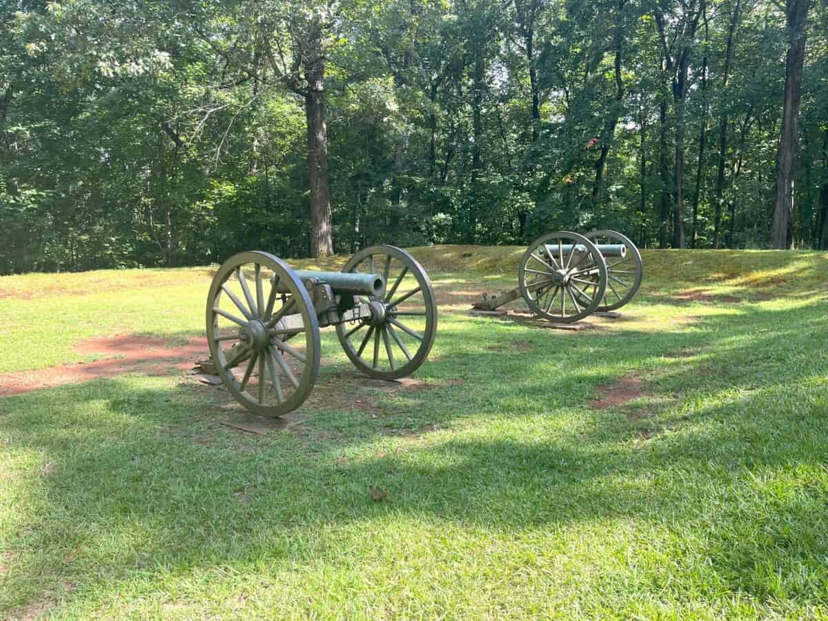
Pigeon Hill
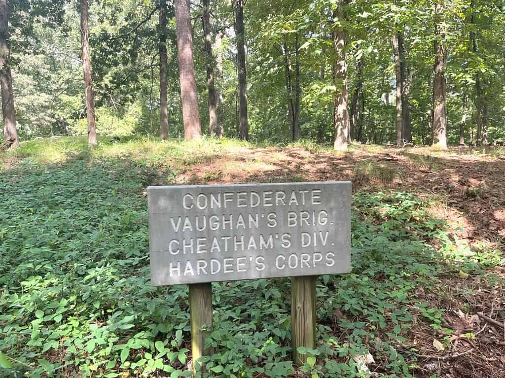
The Battle of Kennesaw occurred primarily in two spots: one at Pigeon Hill (a precipice of Little Kennesaw Mountain) and the other at Cheatham Hill. Two diversionary tactics also occurred: one near the base of the mountain at the present-day visitor center, and another further south. With rainy conditions on the morning of June 27, 1864, 5,500 Union troops slogged through muddy, swamp-like terrain to climb Pigeon Hill. Because the Confederate troops used natural rocks as a protective barrier, they could push rocks downhill to keep the Union troops from gaining a foothold. Later in this post, I’ll cover Cheatham Hill.
The Hike
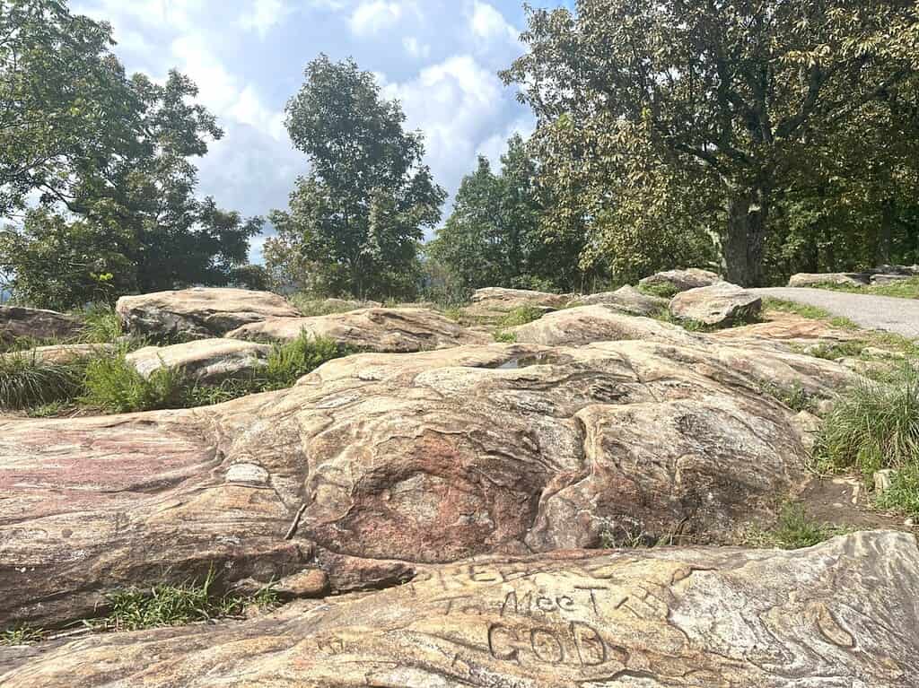
The trail to the top of Kennesaw Mountain starts steep, but flattens out about midway. Soon, the rugged trail climbs again with lots of switchbacks leading to a paved parking lot and observation deck (vehicular traffic to the top of the mountain is allowed on select days). From here, the hike continues just a bit further and you start seeing cannons and plaques with details about he battle. It’s hard to tell when you reach the top, but the trail levels off and you’ll find a big area of rocks to sit down and take in the views.
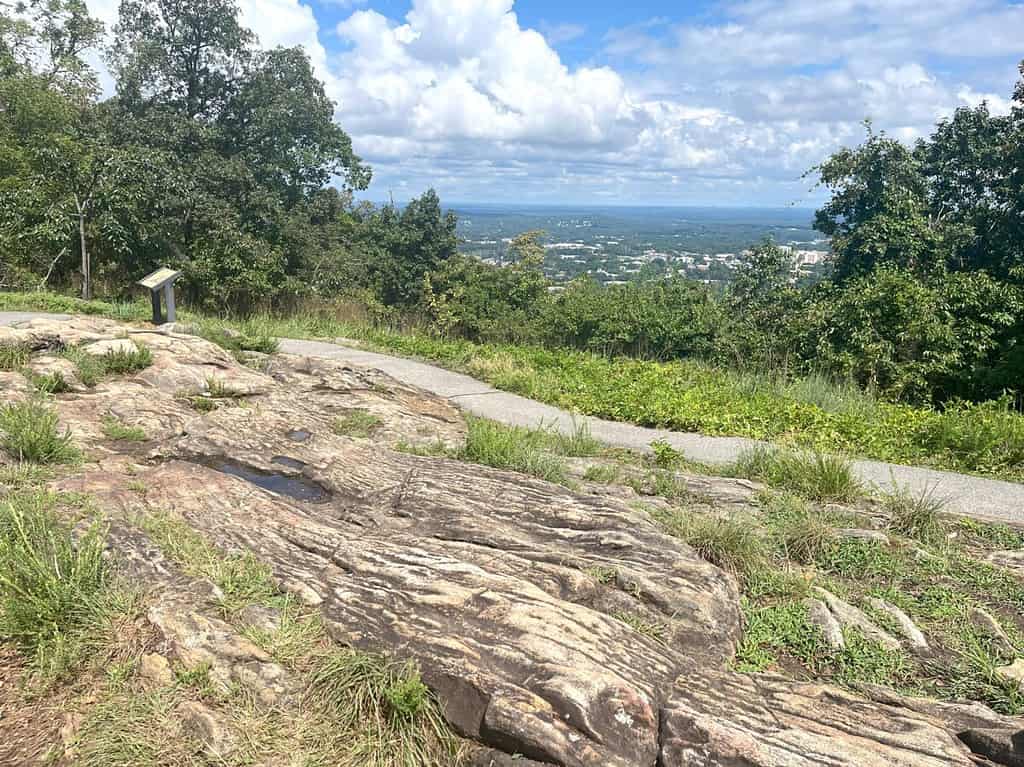
The elevation gain is about 700 feet, so plan to take water with you. Most people take the same trail back down the mountain, completing the 2-mile hike. Alternatively, you can continue hiking to Little Kennesaw Mountain and down to Brumby Camp (the Civilian Conservation Camp in the 1930s) for a five-mile total hike.
Cheatham Hill
After our hike to the top of the mountain, we decided to drive to the Cheatham Hill and Kolb Farmhouse areas of the park. Anyone can hike the trail, but it is a 10.2-mile round-trip from the visitor center to Cheatham Hill – see NPS map. Our drive took us down winding two-lane roads in and out of the NPS property. Outside the park, we briefly travelled on the bustling four-lane GA-120, passing the Marietta High School campus with over 2,500 students. You wouldn’t expect that Cheatham Hill is just a mile away.
Entering the park again, we stopped at the parking lot and noticed maps for an intricate hiking trail system. In all my years in Atlanta, I never knew this area, let alone hiking trails, even existed. Just like our hike to the mountain, we noticed deer out in full force.

The trail to Dead Angle and the Illinois Monument is just about 250 yards. Unlike the trail to the mountain, this trail is mostly level along the remnants of earthworks built by the Confederate troops. The well-preserved site remains quiet and untouched by development.
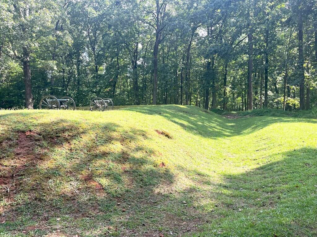
About an hour after the attack on Pigeon Hill, the battle south at Cheatham Hill occurred. The Confederates had built seven miles of earthworks and waited (with ammunition in hand) for the Federal troops. However, at a spot later called the Dead Angle, the Confederate line formed an inverted “V” due to the topography. If Union troops could reach the base of the Dead Angle, they couldn’t be seen from the earthworks eight feet above.
The Battle at Cheatham Hill
In a frontal attack, over 8,000 Federal troops ran across an open field of 400 yards, exposing themselves to gunfire. For those Union soldiers who made it to the “dead space” below Dead Angle, they dug culverts and hid out of sight from the Confederates. Additionally, the Confederate troops couldn’t angle their guns downward at the Union troops below. This allowed the Union troops to climb the earthworks and engage in hand-to-hand combat for a short time.
Mass casualties existed on both sides and the fallen bodies created such a stench in the hot temperatures that the Confederates asked for a truce. This temporary truce allowed troops on both sides to bury their dead. Afterwards, fighting resumed again until the Confederate troops retreated to the Chattahoochee River to gain a better position on July 2, 1864.
Considered a Confederate victory, the Battle of Kennesaw resulted in the deaths of roughly 3,000 Union and 1,000 Confederate soldiers. By September 1, 1864, the Union troops captured Atlanta and began the “March to the Sea” down to Savannah.
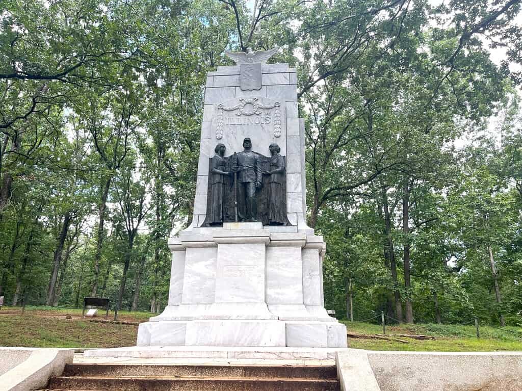
Over 30 years after the Civil War, Union veteran Lansing Downy purchased 60 acres at Cheatham’s Hill in memory of Colonel Dan McCook. Downy transferred the land to the Kennesaw Memorial Association, which dedicated the Illinois Memorial on the 50th anniversary of the Battle of Kennesaw in 1914. Made of Georgia white marble, the monument stands at 25 feet on the earthworks of the Dead Angle.
At the base of the monument is a small tunnel where the Union troops tried to dig their way under the Confederate line. Later, this property, which grew to include Little and Big Kennesaw Mountains, became Kennesaw Mountain National Battlefield Park in 1935.
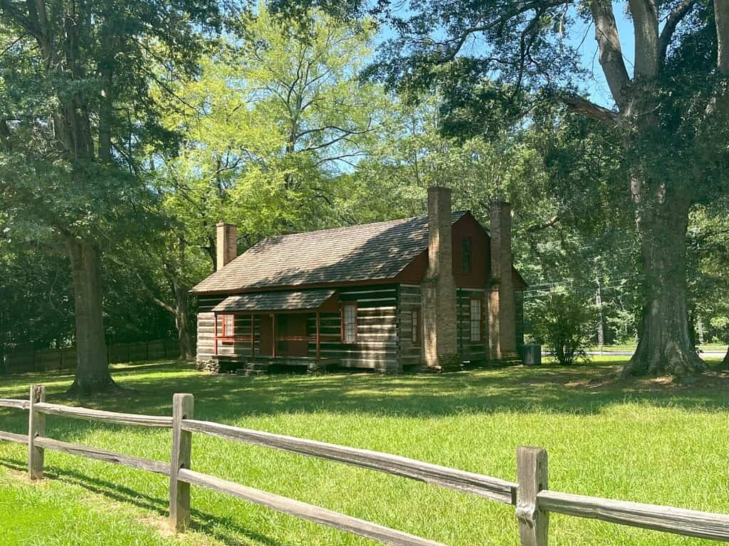
Kolb Farmhouse
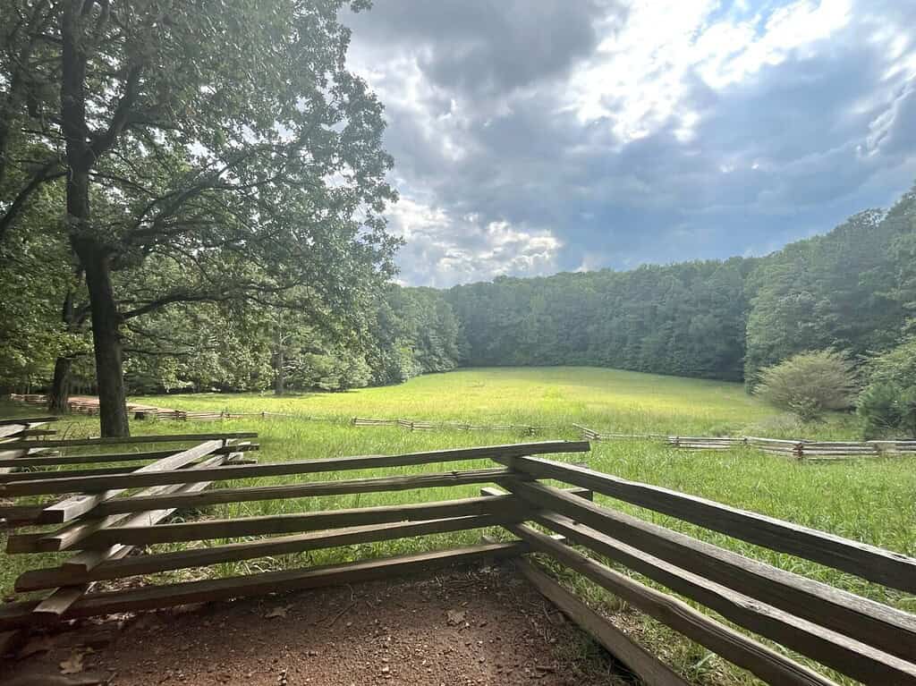
While we could have walked 2.5 miles to Kolb Farm, we drove instead. This working farm, located along the Powder Springs/Marietta Road, set the scene for the Battle of Kennesaw. Confederate General Joseph Johnston moved 13,000 troops from Brushy Mountain to Kolb Farm. Once the Union soldiers realized this, they entrenched themselves near Kolb Farm.
The Confederate troops attacked on June 22, 1864, but lost 1,000 men. Although considered a Confederate defeat, the battle did stop the Union advance. At this point (five days before the Battle of Kennesaw Mountain), Sherman changed tactics from outflanking maneuvers to a full frontal attack.
While the Kolb Farm isn’t open to the public, the NPS restored and owns the cabin today. Visitors can walk around and visit the cemetery of Kolb family members, who fled during 1864 and returned in the 1880s.
In Conclusion
There’s so much more to the park than just the hike up to Kennesaw Mountain. A visit to the museum, the 35-minute film, and a hike or driving tour of Cheatham Hill and Kolb Farm is definitely worth your time. Admission to all of the grounds at Kennesaw Mountain is a $5 parking pass per vehicle or free with an America the Beautiful National Park Pass. For more information, click the park’s website here.